Wednesday, 15 May 2013

The Famous Horseshoe Bend on the Colorado

After our boat cruise on Lake Powell, we still have an afternoon left to explore the area near Page.  The famous Horseshoe Bend, a meander of the Colorado River,is just a short drive south of Page and a short hike from the parking lot.  It is quite spectacular and I can imagine it will look different at various times of the day -  particularly stunning at sunset.  But it is a 1000 ft drop to the bottom and there are no railings.  My heart dropped a few times when we were there watching little kids insist they be let go at the edge of the cliff...


The hike up to the top - the sandy trail required a lot more energy than usual

Once you get to the top you go down again quickly - with the gaping hole at the bottom

The reward - a stunning view of the Horseshoe Bend - but not for the acrophobic


Fearless couples...


Quite a climb back up to the top

Thursday, 9 May 2013

Rainbow Bridge - world's largest known natural bridge

After the full day canyon tour, we had a leisurely day doing a boat tour on Lake Powell which included a short hike to Rainbow Bridge, world's largest known natural bridge, considered sacred by the local Native American tribes.  It was a very enjoyable cruise, with remarkable scenery throughout the two hours.  The worst part was getting up in the morning to get to the marina for the 7:30 am cruise.  There was no other option if we wanted to do the hike to the bridge.

The only food provided on board the six and a half hour cruise were granola bars and apples, with coffee and lemonade.  If you want real food, there was a sunset cruise which included dinner.  But then you won't be able to see the Rainbow Bridge.  And I would opt for the monument rather than the food in Arizona - any time.


Early morning at the marina


The same landscape from the water


Layered bluffs all along Lake Powell


Lots of mesas and buttes around the lake


It seems that everywhere you look you see camel heads


Entrance into the canyon leading to the Rainbow Bridge - you wouldn't think the boat could get through the many narrow channels - but it did

You can see in these two pictures (above and below) what a difference the light can make to the same landscape - the top is an approach to the channel (obviously the wrong angle light-wise) while the photo below is looking back from the other side


The boat let us of on the pier and we hiked along this massive canyon face to get to the Rainbow Bridge Monument


First glimpse of the monument with Navajo Mountain in the background


The perfect arch - Rainbow Bridge, considered sacred by the tribes in the area


Not much snow melt this year - river bed is dry


One of many houseboats on Lake Powell docked here at the Rainbow Bridge pier


The way back to the Marina was just as spectacular as we were then seeing the landscape in a different light and from a different angle


The ever present coal power generating station has become a monument in its own way


The dam that created Lake Powell
and turned it into a beautiful pleasure playground


Monday, 6 May 2013

Sakura in Toronto

The Japanese government presented cherry blossom trees to the people of Toronto to thank them for their support of Japanese Canadian refugees after World War II.  This started a tradition of sakura (cherry blossom viewing) in Toronto.  More than fifty of the trees were planted in High Park.  

On Sunday, I joined hundreds (possibly even thousands) of Torontonians on their annual pilgrimage.  It was a zoo, but the cherry blossoms were gorgeous.  They were in full bloom and in fact most have peaked and there were even some petals falling off.   The weekend before would have been a better time to enjoy both buds and flowers and a weekday would mean a less crowded and more enjoyable park - however, not always an option...


Leaves have already started to come out on some trees


Photographer's paradise


The "stars" were very much in demand, including this "bride" below... 


I've found the trunks as photo-worthy as the flowers...


This is to give you an idea of the crowds and the traffic - DON'T drive.  For many of the people here, it was an expensive parking fee - $105 - the parking control staff had a field day!


The better way...


Sunday, 5 May 2013

Slot Canyon #5 - Mountain Sheep Canyon

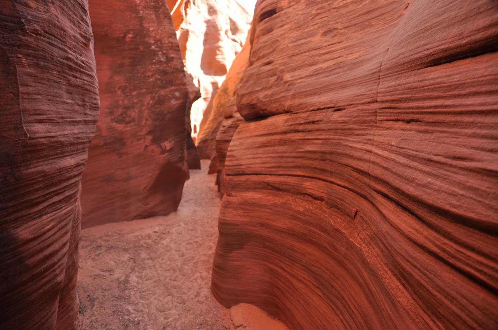
Someone remarked that all the canyons looked very similar.   While the pictures of the sandstone do seemed alike, the canyons themselves are actually quite different with their own character.  They may all have swirls, but the stone texture seemed different in each of them and they were all different heights and widths, thus creating different feel when you were actually in them.  You have to be there.

Mountain Sheep Canyon is the longest canyon of the five (about 1.5 miles) and there is probably a good reason why it's named after the Mountain Sheep - you have to climb up and down quite a few times inside the canyon, like mountain sheep.  The step ladders were secured, but one of them was quite long - climbing up seemed easier as long as you don't look down, but climbing down is not for the faint of heart as you do have to look down to make sure you don't miss a step.  And you have to go back the same way as there is no other way out.   To add to the drama, it was our last canyon of the day, everyone was tired - but we survived.


The entrance to Mountain Sheep Canyon


A well-camouflaged lizard


First time we saw any plant life in the canyons


This canyon is much more rugged than the other four.  You can see that in the stone texture and the harsher lines of the swirls.  


That was a fairly long climb up to a not very steady platform...


Looking down from the platform 


Even the arches you see in this canyon are not as smooth as the ones in the other canyons

Compared to similar shots in the other canyons, you can see the lines here are much more rugged.


And that was the end of our day-long tour of the slot canyons - it was a spectacular adventure!