FRIDAY, 21 OCTOBER 2011
NZ: Wellington, the capital
Wellington, the capital is a very walkable city with a small town feel. You can likely walk from one end of the city to the other in an hour. Architecture is mixed with no one distinct style. You can see below the range -


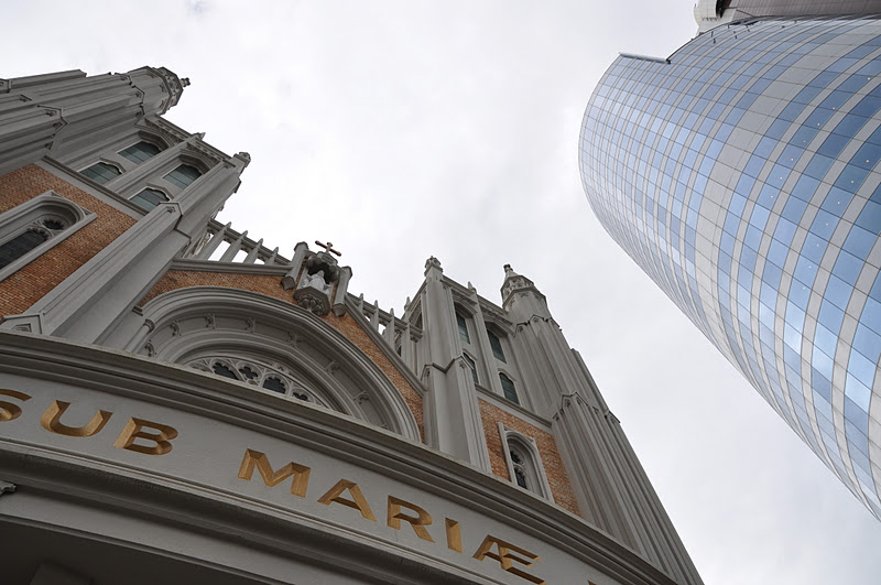
The gothic Catholic Church St. Mary of the Angels, built in 1922, is the parish church of Central Wellington

Here are the capital buildings - the Parliament (what else could it be?!), the "Beehive" to the left is the executive wing...

I guessed quite correctly that this is the Library of Parliament!

And here is the National Library, closed for renovations

The very impressive Te Papa Museum

Maori carving in the museum lobby -

View of the lobby from the 4th floor of the museum -

Carved head of Maori long boat

Marae (meeting house)

Stunning stained glass in Te Papa

View of amphitheatre from the museum


Maori blessing with green stone for good luck
Next: On to the South Island - the best is yet to come!


THURSDAY, 20 OCTOBER 2011
NZ: It's for the birds!
In our quest for a glimpse of the Rowi, the rarest of the world's five species of kiwi, we took a detour on the road to Wellington and stopped by the Mt. Bruce Wildlife Centre. Just my luck, the bird had been moved to allow construction of a new home! This was all we were able to see - a poster; and not a very realistic one at that, as the rowis are really nocturnal animals.
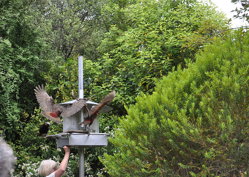
 The Kakas though, put on a great show for us. It was feeding time - they dive-bombed and swooped around at breakneck speeds. The only way I could get them on camera was using multiple shots and hoping for the best.

Caught one in a quiet moment, enjoying its food.

And here's another rare one, the Takahe, a big flightless bird that was almost extinct at one time but now restored to a population of about 225.

The road through the mountains into Wellington was an exciting, windy drive with steep drops on the side. Good thing we were on the inside most of the time! Here is a view from the cable car stop at the top of the hill looking onto Wellington harbour. The cable car stop was right downtown, a block from our hotel.

From the cable car stop, it was a nice walk to the top of the Botanic Garden. This was a good route to take as the gardens were built on a steep hill. It would have been quite a climb had we gone the other way - up instead of down. This is quite a unique species, unfortunately not labelled!


What a great place to build a garden - along the hillside. Here's a top to bottom view.

This pigeon looked like it was dressed up for a night out - look at the pretty collar!


 Handsome!

We were lucky to be there when there was a show of prize-winning roses - this was but one award winner amongst many!

Next post: Wellington, the capital
SATURDAY, 15 OCTOBER 2011
NZ: Napier - Art Deco Capital
Art Deco in New Zealand? Yes, thanks to a massive earthquake which destroyed most of the buildings in 1931, central Napier was almost completely rebuilt in the style of the day, Art Deco. We took a detour to Napier just to see this - of course, the famous wineries in the Hawkes' Bay area were additional enticements. We arrived in time for the afternoon guided walking tour from the Art Deco Centre and was introduced by a knowledgeable docent to a dozen of the 140 buildings from the period. Most of the art deco architecture we had seen before were in northern climes, Cuba being the exception. We found this "Art Deco Capital" quite unusual against the backdrop of palm trees and a Mediterranean climate.

The renovated Devon House foyer

One of the most important buildings: the Napier Municipal Theatre


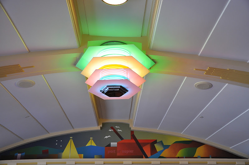
Fixtures and art inside the Theatre


A number of shops had kept the art glass above their display windows


An Art Deco church is also uncommon

And finally, wrapping up the day at the Mission Estate Winery restaurant, we had one of the best meals on the trip!


The juiciest, tastiest lamb ever!

Melt-in-your mouth truffle cake

Stunning view of the vineyard and Napier in the distance
THURSDAY, 13 OCTOBER 2011
NZ: Tongariro National Park
From Rotorua, we headed south to our destination,Tongariro National Park with its famous Tongariro Crossing. As with our trip to Gros Morne in Newfoundland, this was the ultimate challenge for us - would we be able to do this strenuous day hike? That was on our mind as we made our way south towards the two active volcanoes - Mt. Ruapehu at 2,797 metres, the highest mountain on the North Island, last erupted only in 1995-96; and Mt. Ngauruhoe, at 2,287 metres and last erupted in 1974-75.
On the way, we stopped for lunch at the Huka Falls which you see below. It was not very big but the current compressed into a narrow channel became quite powerful at the falls and was quite spectacular. We also stopped by a shrimp farm and bought live shrimp for dinner together with gigantic fresh mussels. It was our first opportunity to cook in 12 days - the only way to eat seafood the way we wanted it. And it was heavenly!


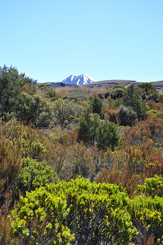
View of Mt. Ruapehu from across Lake Taupo and you will see many more views of this beautiful mountain below...

Mt. Ruapehu from the highway
After our stop at the Visitor Centre and talking to the ranger, we concluded that the Crossing was beyond our reach. The rocky terrain that would take us up to the crossing reminded us of Gros Morne and the very difficult climb up. The biggest problem was that we would be dependent on being picked up by a bus at the end of the hike at a certain hour. If we couldn't make it on time, we would be stuck. That was the deal breaker. We settled for the less strenuous Two Lakes hike, a "short" 2.5 hour hike that promised spectacular views nevertheless. We prepared ourselves for a full day hike based on previous experience - we typically would take two to three times longer than the average hiker - and we were right!

Mt. Ngauruhoe seen at the beginning of the hike

A postcard shot of vegetation on the hike with the destination always in view!

We added our own pile to this community effort by hikers on the trail

Eyes on the prize!

Tongariro Waterfall - the trail would take us all the way to the top

Closer to the top

Mt. Taranaki on the west coast was visible in the distance

The great thing about this hike was that you could see far ahead and know what you would be faced with - it was always reassuring to see other hikers taking it easy...

Destination! First lake and Mt. Ruapehu in the background. One of the most spectacular places for a picnic lunch! And a decision point - should we continue up to the second lake? It was a steep climb to a saddle with steep drops on either side. Could I make it up? Could I make it down? Ben was keen to continue. I was tempted to sit and enjoy the view. But the enticement of yet another view pushed me to climb to the top.

We made it! Lake #2 and Mt. Nauruhoe watching over it. This was the point where we were in between the two lakes and the two mountains, one on each side. These two shots were taken from opposite sides of the same saddle.

From this point, It was another 3-4 hours to get back, with many stops on the way and fast declining strength. But it was all worth it! This was the high point of our NZ trip!

MONDAY, 10 OCTOBER 2011
NZ: Te Puia, Rotorua
Rotorua is Maori heartland. We couldn't leave it without experiencing some Maori culture, even if it's a touristy bit of it. We went to Te Puia, the New Zealand Maori Arts & Crafts Institue, which offered an evening Maori culture package including a Maori welcome, kapa haka (Maori performing arts concert), Maori feast with traditional hangi (earth-cooked oven meal) and a night tour of the illuminated Pohutu geyser. The culture showcase was dignified, the food excellent and the geyser spectacular. It turned out to be a very enjoyable evening.

Maori carving

At the entrance, monumental posts spiral towards the heavens, each representing a divine realm

Welcome ceremony

Dance performance

Maori singers - powerful operatic performances

Spectacular Pohutu geyser, the largest in the Southern Hemisphere


Stone at entrance that you rub for good luck as you leave
SUNDAY, 9 OCTOBER 2011
NZ: Hell's Gate, Rotorua
The Wai-O-Tapu thermal park so whetted our appetite for volcanic activity, we went on to another thermal park in the afternoon. Hell's Gate (Tikitere) was seriously volcanic with hot boiling mudpools and boasted the largest mud volcano in NZ. I could still smell sulphur when I looked at the photos again. The park sits on a magma spike, which accounted for the high temperatures of its waters. It is owned by the Maoris but was actually named by George Bernard Shaw, who so impressed the Maoris when he visited, they let him name the various sights in the park. The park also offered a mudbath experience, supposedly good for arthritis,not to mention possible "powers of foresight". I expected to be up to my neck in mud, but was a little disappointed to find it was only mud water - I have to dig up the mud from the bottom of the bath to smear it over myself. It was quite an experience nevertheless - sulphur immersion.

Devil's Bath: The water of this shallow pool was used for bathing by the "Tohunga" (high priest) who attributed his powers of foresight to the sulphur waters of Tikitere

One of many bubbling mud pools

Here is a graphic explanation of what is happening at Hell's Gate
 A post-apocalyptic landscape

But the vegetation survived

Ink pots

New Zealand's largest mud volcano

Odd place for a piece of driftwood

The Cooking Pool - with a constant temperature of 98 degrees C, an adult pig can cook in 2 hours, smells of sulphur, but apparently "tastes great"

The Sulphur Pool

"Sodom and Gomorrah" (Shaw's naming)

And in the midst of this barren landscape, spring flowers!
THURSDAY, 6 OCTOBER 2011
NZ: Wai-O-Tapu Thermal Park
Just 20 minutes south of Rotorua is the bubbling Wai-O-Tapu Geothermal Park, a wonderland of boiling mudpools, coloured hot and cold pools, volcanic craters and the Lady Knox Geyser that erupts on schedule once a day up to 20 metres. Visitors trek through these natural phenomenons on self-guided tours that could take a couple of hours, longer if you take photos and it is a photographer's dream with its multi-coloured steaming pools and rocks.

Lady Knox "smoking"

Start of the eruption

Almost there...

There!

Volcanic craters abound

Different views of the Champagne Pool


How is this formed? See below...


Coloured vegetation

Coloured rocks

Beautiful vista: green lake in the park - we had to line up on a lookout to take this photo

The Champagne pool looked different on the return trip

The colour is authentic - I took enough shots until I got it right!
FRIDAY, 21 OCTOBER 2011
NZ: Wellington, the capital
Wellington, the capital is a very walkable city with a small town feel. You can likely walk from one end of the city to the other in an hour. Architecture is mixed with no one distinct style. You can see below the range -
The gothic Catholic Church St. Mary of the Angels, built in 1922, is the parish church of Central Wellington
Here are the capital buildings - the Parliament (what else could it be?!), the "Beehive" to the left is the executive wing...
I guessed quite correctly that this is the Library of Parliament!
And here is the National Library, closed for renovations
The very impressive Te Papa Museum
Maori carving in the museum lobby -
View of the lobby from the 4th floor of the museum -
Carved head of Maori long boat
Marae (meeting house)
Stunning stained glass in Te Papa
View of amphitheatre from the museum
Maori blessing with green stone for good luck
Next: On to the South Island - the best is yet to come!
THURSDAY, 20 OCTOBER 2011
NZ: It's for the birds!
In our quest for a glimpse of the Rowi, the rarest of the world's five species of kiwi, we took a detour on the road to Wellington and stopped by the Mt. Bruce Wildlife Centre. Just my luck, the bird had been moved to allow construction of a new home! This was all we were able to see - a poster; and not a very realistic one at that, as the rowis are really nocturnal animals.
The Kakas though, put on a great show for us. It was feeding time - they dive-bombed and swooped around at breakneck speeds. The only way I could get them on camera was using multiple shots and hoping for the best.
Caught one in a quiet moment, enjoying its food.
And here's another rare one, the Takahe, a big flightless bird that was almost extinct at one time but now restored to a population of about 225.
The road through the mountains into Wellington was an exciting, windy drive with steep drops on the side. Good thing we were on the inside most of the time! Here is a view from the cable car stop at the top of the hill looking onto Wellington harbour. The cable car stop was right downtown, a block from our hotel.
From the cable car stop, it was a nice walk to the top of the Botanic Garden. This was a good route to take as the gardens were built on a steep hill. It would have been quite a climb had we gone the other way - up instead of down. This is quite a unique species, unfortunately not labelled!
What a great place to build a garden - along the hillside. Here's a top to bottom view.
This pigeon looked like it was dressed up for a night out - look at the pretty collar!
Handsome!
We were lucky to be there when there was a show of prize-winning roses - this was but one award winner amongst many!
Next post: Wellington, the capital
SATURDAY, 15 OCTOBER 2011
NZ: Napier - Art Deco Capital
Art Deco in New Zealand? Yes, thanks to a massive earthquake which destroyed most of the buildings in 1931, central Napier was almost completely rebuilt in the style of the day, Art Deco. We took a detour to Napier just to see this - of course, the famous wineries in the Hawkes' Bay area were additional enticements. We arrived in time for the afternoon guided walking tour from the Art Deco Centre and was introduced by a knowledgeable docent to a dozen of the 140 buildings from the period. Most of the art deco architecture we had seen before were in northern climes, Cuba being the exception. We found this "Art Deco Capital" quite unusual against the backdrop of palm trees and a Mediterranean climate.
The renovated Devon House foyer
One of the most important buildings: the Napier Municipal Theatre
Fixtures and art inside the Theatre
A number of shops had kept the art glass above their display windows
An Art Deco church is also uncommon
And finally, wrapping up the day at the Mission Estate Winery restaurant, we had one of the best meals on the trip!
The juiciest, tastiest lamb ever!
Melt-in-your mouth truffle cake
Stunning view of the vineyard and Napier in the distance
THURSDAY, 13 OCTOBER 2011
NZ: Tongariro National Park
From Rotorua, we headed south to our destination,Tongariro National Park with its famous Tongariro Crossing. As with our trip to Gros Morne in Newfoundland, this was the ultimate challenge for us - would we be able to do this strenuous day hike? That was on our mind as we made our way south towards the two active volcanoes - Mt. Ruapehu at 2,797 metres, the highest mountain on the North Island, last erupted only in 1995-96; and Mt. Ngauruhoe, at 2,287 metres and last erupted in 1974-75.
On the way, we stopped for lunch at the Huka Falls which you see below. It was not very big but the current compressed into a narrow channel became quite powerful at the falls and was quite spectacular. We also stopped by a shrimp farm and bought live shrimp for dinner together with gigantic fresh mussels. It was our first opportunity to cook in 12 days - the only way to eat seafood the way we wanted it. And it was heavenly!
View of Mt. Ruapehu from across Lake Taupo and you will see many more views of this beautiful mountain below...
Mt. Ruapehu from the highway
After our stop at the Visitor Centre and talking to the ranger, we concluded that the Crossing was beyond our reach. The rocky terrain that would take us up to the crossing reminded us of Gros Morne and the very difficult climb up. The biggest problem was that we would be dependent on being picked up by a bus at the end of the hike at a certain hour. If we couldn't make it on time, we would be stuck. That was the deal breaker. We settled for the less strenuous Two Lakes hike, a "short" 2.5 hour hike that promised spectacular views nevertheless. We prepared ourselves for a full day hike based on previous experience - we typically would take two to three times longer than the average hiker - and we were right!
Mt. Ngauruhoe seen at the beginning of the hike
A postcard shot of vegetation on the hike with the destination always in view!
We added our own pile to this community effort by hikers on the trail
Eyes on the prize!
Tongariro Waterfall - the trail would take us all the way to the top
Closer to the top
Mt. Taranaki on the west coast was visible in the distance
The great thing about this hike was that you could see far ahead and know what you would be faced with - it was always reassuring to see other hikers taking it easy...
Destination! First lake and Mt. Ruapehu in the background. One of the most spectacular places for a picnic lunch! And a decision point - should we continue up to the second lake? It was a steep climb to a saddle with steep drops on either side. Could I make it up? Could I make it down? Ben was keen to continue. I was tempted to sit and enjoy the view. But the enticement of yet another view pushed me to climb to the top.
We made it! Lake #2 and Mt. Nauruhoe watching over it. This was the point where we were in between the two lakes and the two mountains, one on each side. These two shots were taken from opposite sides of the same saddle.
From this point, It was another 3-4 hours to get back, with many stops on the way and fast declining strength. But it was all worth it! This was the high point of our NZ trip!
MONDAY, 10 OCTOBER 2011
NZ: Te Puia, Rotorua
Rotorua is Maori heartland. We couldn't leave it without experiencing some Maori culture, even if it's a touristy bit of it. We went to Te Puia, the New Zealand Maori Arts & Crafts Institue, which offered an evening Maori culture package including a Maori welcome, kapa haka (Maori performing arts concert), Maori feast with traditional hangi (earth-cooked oven meal) and a night tour of the illuminated Pohutu geyser. The culture showcase was dignified, the food excellent and the geyser spectacular. It turned out to be a very enjoyable evening.
Maori carving
At the entrance, monumental posts spiral towards the heavens, each representing a divine realm
Welcome ceremony
Dance performance
Maori singers - powerful operatic performances
Spectacular Pohutu geyser, the largest in the Southern Hemisphere
Stone at entrance that you rub for good luck as you leave
FRIDAY, 21 OCTOBER 2011
NZ: Wellington, the capital
Wellington, the capital is a very walkable city with a small town feel. You can likely walk from one end of the city to the other in an hour. Architecture is mixed with no one distinct style. You can see below the range -
The gothic Catholic Church St. Mary of the Angels, built in 1922, is the parish church of Central Wellington
Here are the capital buildings - the Parliament (what else could it be?!), the "Beehive" to the left is the executive wing...
I guessed quite correctly that this is the Library of Parliament!
And here is the National Library, closed for renovations
The very impressive Te Papa Museum
Maori carving in the museum lobby -
View of the lobby from the 4th floor of the museum -
Carved head of Maori long boat
Marae (meeting house)
Stunning stained glass in Te Papa
View of amphitheatre from the museum
Maori blessing with green stone for good luck
Next: On to the South Island - the best is yet to come!
THURSDAY, 20 OCTOBER 2011
NZ: It's for the birds!
In our quest for a glimpse of the Rowi, the rarest of the world's five species of kiwi, we took a detour on the road to Wellington and stopped by the Mt. Bruce Wildlife Centre. Just my luck, the bird had been moved to allow construction of a new home! This was all we were able to see - a poster; and not a very realistic one at that, as the rowis are really nocturnal animals.
The Kakas though, put on a great show for us. It was feeding time - they dive-bombed and swooped around at breakneck speeds. The only way I could get them on camera was using multiple shots and hoping for the best.
Caught one in a quiet moment, enjoying its food.
And here's another rare one, the Takahe, a big flightless bird that was almost extinct at one time but now restored to a population of about 225.
The road through the mountains into Wellington was an exciting, windy drive with steep drops on the side. Good thing we were on the inside most of the time! Here is a view from the cable car stop at the top of the hill looking onto Wellington harbour. The cable car stop was right downtown, a block from our hotel.
From the cable car stop, it was a nice walk to the top of the Botanic Garden. This was a good route to take as the gardens were built on a steep hill. It would have been quite a climb had we gone the other way - up instead of down. This is quite a unique species, unfortunately not labelled!
What a great place to build a garden - along the hillside. Here's a top to bottom view.
This pigeon looked like it was dressed up for a night out - look at the pretty collar!
Handsome!
We were lucky to be there when there was a show of prize-winning roses - this was but one award winner amongst many!
Next post: Wellington, the capital
SATURDAY, 15 OCTOBER 2011
NZ: Napier - Art Deco Capital
Art Deco in New Zealand? Yes, thanks to a massive earthquake which destroyed most of the buildings in 1931, central Napier was almost completely rebuilt in the style of the day, Art Deco. We took a detour to Napier just to see this - of course, the famous wineries in the Hawkes' Bay area were additional enticements. We arrived in time for the afternoon guided walking tour from the Art Deco Centre and was introduced by a knowledgeable docent to a dozen of the 140 buildings from the period. Most of the art deco architecture we had seen before were in northern climes, Cuba being the exception. We found this "Art Deco Capital" quite unusual against the backdrop of palm trees and a Mediterranean climate.
The renovated Devon House foyer
One of the most important buildings: the Napier Municipal Theatre
Fixtures and art inside the Theatre
A number of shops had kept the art glass above their display windows
An Art Deco church is also uncommon
And finally, wrapping up the day at the Mission Estate Winery restaurant, we had one of the best meals on the trip!
The juiciest, tastiest lamb ever!
Melt-in-your mouth truffle cake
Stunning view of the vineyard and Napier in the distance
FRIDAY, 21 OCTOBER 2011
NZ: Wellington, the capital
Wellington, the capital is a very walkable city with a small town feel. You can likely walk from one end of the city to the other in an hour. Architecture is mixed with no one distinct style. You can see below the range -
The gothic Catholic Church St. Mary of the Angels, built in 1922, is the parish church of Central Wellington
Here are the capital buildings - the Parliament (what else could it be?!), the "Beehive" to the left is the executive wing...
I guessed quite correctly that this is the Library of Parliament!
And here is the National Library, closed for renovations
The very impressive Te Papa Museum
Maori carving in the museum lobby -
View of the lobby from the 4th floor of the museum -
Carved head of Maori long boat
Marae (meeting house)
Stunning stained glass in Te Papa
View of amphitheatre from the museum
Maori blessing with green stone for good luck
Next: On to the South Island - the best is yet to come!
NZ: Wellington, the capital
Wellington, the capital is a very walkable city with a small town feel. You can likely walk from one end of the city to the other in an hour. Architecture is mixed with no one distinct style. You can see below the range -
Here are the capital buildings - the Parliament (what else could it be?!), the "Beehive" to the left is the executive wing...
I guessed quite correctly that this is the Library of Parliament!
And here is the National Library, closed for renovations
The very impressive Te Papa Museum
Maori carving in the museum lobby -
View of the lobby from the 4th floor of the museum -
Carved head of Maori long boat
Marae (meeting house)
Stunning stained glass in Te Papa
View of amphitheatre from the museum
 |


The gothic Catholic Church St. Mary of the Angels, built in 1922, is the parish church of Central Wellington

Here are the capital buildings - the Parliament (what else could it be?!), the "Beehive" to the left is the executive wing...

I guessed quite correctly that this is the Library of Parliament!

And here is the National Library, closed for renovations

The very impressive Te Papa Museum

Maori carving in the museum lobby -

View of the lobby from the 4th floor of the museum -

Carved head of Maori long boat

Marae (meeting house)

Stunning stained glass in Te Papa

View of amphitheatre from the museum

 |
| Maori blessing with green stone for good luck Next: On to the South Island - the best is yet to come! |
THURSDAY, 20 OCTOBER 2011
NZ: It's for the birds!
In our quest for a glimpse of the Rowi, the rarest of the world's five species of kiwi, we took a detour on the road to Wellington and stopped by the Mt. Bruce Wildlife Centre. Just my luck, the bird had been moved to allow construction of a new home! This was all we were able to see - a poster; and not a very realistic one at that, as the rowis are really nocturnal animals.

The Kakas though, put on a great show for us. It was feeding time - they dive-bombed and swooped around at breakneck speeds. The only way I could get them on camera was using multiple shots and hoping for the best.
Caught one in a quiet moment, enjoying its food.

And here's another rare one, the Takahe, a big flightless bird that was almost extinct at one time but now restored to a population of about 225.

The road through the mountains into Wellington was an exciting, windy drive with steep drops on the side. Good thing we were on the inside most of the time! Here is a view from the cable car stop at the top of the hill looking onto Wellington harbour. The cable car stop was right downtown, a block from our hotel.

From the cable car stop, it was a nice walk to the top of the Botanic Garden. This was a good route to take as the gardens were built on a steep hill. It would have been quite a climb had we gone the other way - up instead of down. This is quite a unique species, unfortunately not labelled!


What a great place to build a garden - along the hillside. Here's a top to bottom view.

This pigeon looked like it was dressed up for a night out - look at the pretty collar!


We were lucky to be there when there was a show of prize-winning roses - this was but one award winner amongst many!

Next post: Wellington, the capital
NZ: Napier - Art Deco Capital
Art Deco in New Zealand? Yes, thanks to a massive earthquake which destroyed most of the buildings in 1931, central Napier was almost completely rebuilt in the style of the day, Art Deco. We took a detour to Napier just to see this - of course, the famous wineries in the Hawkes' Bay area were additional enticements. We arrived in time for the afternoon guided walking tour from the Art Deco Centre and was introduced by a knowledgeable docent to a dozen of the 140 buildings from the period. Most of the art deco architecture we had seen before were in northern climes, Cuba being the exception. We found this "Art Deco Capital" quite unusual against the backdrop of palm trees and a Mediterranean climate.
 |
| The renovated Devon House foyer |
 |
| One of the most important buildings: the Napier Municipal Theatre |

 |
| Fixtures and art inside the Theatre |
 |
 |
| A number of shops had kept the art glass above their display windows |


 |
| An Art Deco church is also uncommon |

And finally, wrapping up the day at the Mission Estate Winery restaurant, we had one of the best meals on the trip!

 |
| The juiciest, tastiest lamb ever! |
 |
| Melt-in-your mouth truffle cake |
 |
| Stunning view of the vineyard and Napier in the distance |
THURSDAY, 13 OCTOBER 2011
NZ: Tongariro National Park
From Rotorua, we headed south to our destination,Tongariro National Park with its famous Tongariro Crossing. As with our trip to Gros Morne in Newfoundland, this was the ultimate challenge for us - would we be able to do this strenuous day hike? That was on our mind as we made our way south towards the two active volcanoes - Mt. Ruapehu at 2,797 metres, the highest mountain on the North Island, last erupted only in 1995-96; and Mt. Ngauruhoe, at 2,287 metres and last erupted in 1974-75.
On the way, we stopped for lunch at the Huka Falls which you see below. It was not very big but the current compressed into a narrow channel became quite powerful at the falls and was quite spectacular. We also stopped by a shrimp farm and bought live shrimp for dinner together with gigantic fresh mussels. It was our first opportunity to cook in 12 days - the only way to eat seafood the way we wanted it. And it was heavenly!


 |
| View of Mt. Ruapehu from across Lake Taupo and you will see many more views of this beautiful mountain below... |
 |
| Mt. Ruapehu from the highway |
 |
| Mt. Ngauruhoe seen at the beginning of the hike |
 |
| A postcard shot of vegetation on the hike with the destination always in view! |
 |
| We added our own pile to this community effort by hikers on the trail |
 |
| Eyes on the prize! |
 |
| Tongariro Waterfall - the trail would take us all the way to the top |
 |
| Closer to the top |
 |
| Mt. Taranaki on the west coast was visible in the distance |
 |
| The great thing about this hike was that you could see far ahead and know what you would be faced with - it was always reassuring to see other hikers taking it easy... |
 |
| Destination! First lake and Mt. Ruapehu in the background. One of the most spectacular places for a picnic lunch! And a decision point - should we continue up to the second lake? It was a steep climb to a saddle with steep drops on either side. Could I make it up? Could I make it down? Ben was keen to continue. I was tempted to sit and enjoy the view. But the enticement of yet another view pushed me to climb to the top. |
 |
| We made it! Lake #2 and Mt. Nauruhoe watching over it. This was the point where we were in between the two lakes and the two mountains, one on each side. These two shots were taken from opposite sides of the same saddle. |
 |
From this point, It was another 3-4 hours to get back, with many stops on the way and fast declining strength. But it was all worth it! This was the high point of our NZ trip! |

NZ: Te Puia, Rotorua
Rotorua is Maori heartland. We couldn't leave it without experiencing some Maori culture, even if it's a touristy bit of it. We went to Te Puia, the New Zealand Maori Arts & Crafts Institue, which offered an evening Maori culture package including a Maori welcome, kapa haka (Maori performing arts concert), Maori feast with traditional hangi (earth-cooked oven meal) and a night tour of the illuminated Pohutu geyser. The culture showcase was dignified, the food excellent and the geyser spectacular. It turned out to be a very enjoyable evening.
 |
| Maori carving |
 |
| At the entrance, monumental posts spiral towards the heavens, each representing a divine realm |
 |
| Welcome ceremony |
 |
| Dance performance |
 |
| Maori singers - powerful operatic performances |
 |
| Spectacular Pohutu geyser, the largest in the Southern Hemisphere |


 |
| Stone at entrance that you rub for good luck as you leave |
SUNDAY, 9 OCTOBER 2011
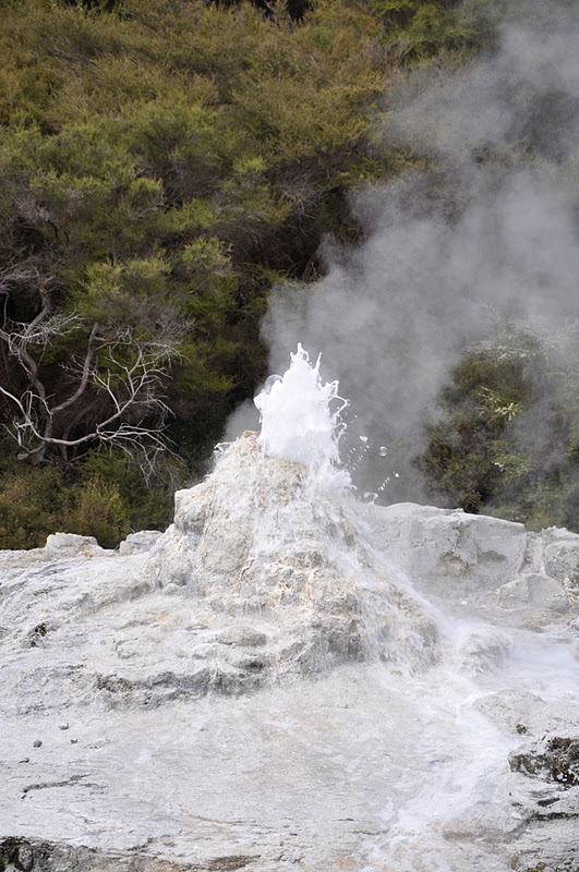
NZ: Hell's Gate, Rotorua
The Wai-O-Tapu thermal park so whetted our appetite for volcanic activity, we went on to another thermal park in the afternoon. Hell's Gate (Tikitere) was seriously volcanic with hot boiling mudpools and boasted the largest mud volcano in NZ. I could still smell sulphur when I looked at the photos again. The park sits on a magma spike, which accounted for the high temperatures of its waters. It is owned by the Maoris but was actually named by George Bernard Shaw, who so impressed the Maoris when he visited, they let him name the various sights in the park. The park also offered a mudbath experience, supposedly good for arthritis,not to mention possible "powers of foresight". I expected to be up to my neck in mud, but was a little disappointed to find it was only mud water - I have to dig up the mud from the bottom of the bath to smear it over myself. It was quite an experience nevertheless - sulphur immersion.
 |
| Devil's Bath: The water of this shallow pool was used for bathing by the "Tohunga" (high priest) who attributed his powers of foresight to the sulphur waters of Tikitere |
|
| One of many bubbling mud pools |
|
| Here is a graphic explanation of what is happening at Hell's Gate |

A post-apocalyptic landscape
 |
| But the vegetation survived |
 |
| Ink pots |
 |
| New Zealand's largest mud volcano |
 |
| Odd place for a piece of driftwood |
 |
| The Cooking Pool - with a constant temperature of 98 degrees C, an adult pig can cook in 2 hours, smells of sulphur, but apparently "tastes great" |
 |
| The Sulphur Pool |
 |
| "Sodom and Gomorrah" (Shaw's naming) |
 |
| And in the midst of this barren landscape, spring flowers! |
NZ: Wai-O-Tapu Thermal Park
Just 20 minutes south of Rotorua is the bubbling Wai-O-Tapu Geothermal Park, a wonderland of boiling mudpools, coloured hot and cold pools, volcanic craters and the Lady Knox Geyser that erupts on schedule once a day up to 20 metres. Visitors trek through these natural phenomenons on self-guided tours that could take a couple of hours, longer if you take photos and it is a photographer's dream with its multi-coloured steaming pools and rocks.
 |
| Lady Knox "smoking" |
 |
| Start of the eruption |
|
| Almost there... |
|
| There! |
 |
| Volcanic craters abound |
 |
| Different views of the Champagne Pool |

 |
| How is this formed? See below... |
 |
 |
| Coloured vegetation |
 |
| Coloured rocks |
 |
| Beautiful vista: green lake in the park - we had to line up on a lookout to take this photo |
 |
| The Champagne pool looked different on the return trip |
 |
| The colour is authentic - I took enough shots until I got it right! |
MONDAY, 3 OCTOBER 2011
NZ: The Road to Rotorua
Rotorua, the geothermal capital of New Zealand sitting fearlessly on the Pacific Rim of Fire, was only a few hours from Auckland by car. We took the long way there in order to take in the glow worm caves in Waitomo. Visiting the caves was a magical experience - stage carefully set by the low-key Maori guide who sang a sacred Maori hymn for us, his beautiful baritone resounding in the cavernous interior of the limestone caves. He asked for silence when we hopped on boats to enter the darkest part of the caves where the glow worms were found. Lifting our eyes, we gaped at the magical sight of a million glow worms in the pitch black roof of the caves - the effect was absolute enchantment, a spiritual experience.
The visitor centre was itself stunning architecturally. Rebuilt after a devastating fire, it was an award- winning structure that was a showcase on its own. You see below the steps leading to the entrance and the innovative roof over the complex.
The visitor centre was itself stunning architecturally. Rebuilt after a devastating fire, it was an award- winning structure that was a showcase on its own. You see below the steps leading to the entrance and the innovative roof over the complex.


A glimpse of the caves from the exit.

Photos were not allowed inside - a photo of the poster was the best I could do!

The rolling landscape around the caves was quite striking.

It didn't take us long to get to Rotorua. And you couldn't miss it for the smell of sulphur! The waterfront is the tamest part of the town.

Even the swans had to be black to fit in!

For a foretaste of the sights to come - a boiling mud pool in the neighbourhood park! This was the stuff that nightmares were made of, that unforgettable scene of the man sinking in the mudpool in the "Hound of the Baskervilles" still haunted me half a century later...

Sunday, 2 October 2011
NZ: Auckland, city of volcanoes
Auckland actually sits on an active volcanic field with 49 volcanoes! According to the GeoNet site at http://www.geonet.org.nz/volcano/our-volcanoes/auckland-volcanic-field.html these volcanoes are unlikely to be active again. A trusty lot, these Aucklanders. They even built their museum right on top of a crater! It was fun though checking out all these volcanoes that one can easily get to on a short drive around the City. Our first stop was Devonport where we drove up a steep road to the top of Mt. Victoria, the tallest volcano in Auckland. We were rewarded by a panoramic view of the city and harbour and the perfect cone of the largest volcano in Auckland, Rangitoto Island. If we had more time, we would have spent more time wandering around Devonport, often compared to Sausalito in the San Francisco Bay area. But we were on a quest for volcanoes!
 |
Auckland Museum sitting on a crater |
 |
Rangitoto Island, the largest of the Auckland volcanoes, last erupted 600 years ago |
 |
View of the harbour and the other volcanoes in Auckland |

 |
Auckland skyline |
 |
Crater! |
 |
Standing on the rim of one crater and looking across town at the other two volcanoes |
 |
One Tree Hill, another volcano |
 |
Obelisk at the top of One Tree Hill |
 |
The slopes of the volcano is now a sheep farm in the middle of the city! |

 |
They don't look very sheepish, do they?! |
TUESDAY, 27 SEPTEMBER 2011
NZ: Auckland, the largest city
The largest city in New Zealand has a small town feel, that's the remarkable thing about this country, this city. It has a population of over 1.3 million, but the streets are not crowded. The city is quite spread out and it doesn't have a lot of high rises except in the downtown area. It has the largest Polynesian population in the world, which explains why the city is bilingual everywhere. We were surprised to see bilingual signs all over the library, even in the book return slots! What strikes us was that the aboriginal population here in NZ seems to be in a much better position than their counterparts in Australia, the little that we have seen of both countries.
 |
| Historic clock tower (1926) on the University of Auckland campus |
 |
| A traffic jam, heaven forbid! |
 |
| See the mix of architectural styles, Italian renaissance revival Town Hall beside art deco |
 |
| Historic art deco theatre |
 |
| Landmark SkyCity - tallest man-made structure in the country |

 |
| Birds of paradise in the gardens |
 |
| Gorgeous tree! |
 |
| It's just a condo - but I love this photo! |
 |
| Aotea Square - amazing Earth from Above exhibit by photographer Yann Arthus-Bertrand behind Maori gate |
 |
| Love this! |
 |
| The downtown library is a converted cinema |
 |
| You can almost picture the cinema lounge... |
 |
| Iconic burger van eatery in downtown Auckland since 1948 |
 |
| SkyCity at night |
 |
| Crispy Chinese BBQ duck cafe near the university was a pleasant surprise Next: Auckland, the city of volcanoes |