From Rotorua, we headed south to our destination,Tongariro National Park with its famous Tongariro Crossing. As with our trip to Gros Morne in Newfoundland, this was the ultimate challenge for us - would we be able to do this strenuous day hike? That was on our mind as we made our way south towards the two active volcanoes - Mt. Ruapehu at 2,797 metres, the highest mountain on the North Island, last erupted only in 1995-96; and Mt. Ngauruhoe, at 2,287 metres and last erupted in 1974-75.
On the way, we stopped for lunch at the Huka Falls which you see below. It was not very big but the current compressed into a narrow channel became quite powerful at the falls and was quite spectacular. We also stopped by a shrimp farm and bought live shrimp for dinner together with gigantic fresh mussels. It was our first opportunity to cook in 12 days - the only way to eat seafood the way we wanted it. And it was heavenly!
 |
| View of Mt. Ruapehu from across Lake Taupo and you will see many more views of this beautiful mountain below... |
 |
| Mt. Ruapehu from the highway |
After our stop at the Visitor Centre and talking to the ranger, we concluded that the Crossing was beyond our reach. The rocky terrain that would take us up to the crossing reminded us of Gros Morne and the very difficult climb up. The biggest problem was that we would be dependent on being picked up by a bus at the end of the hike at a certain hour. If we couldn't make it on time, we would be stuck. That was the deal breaker. We settled for the less strenuous Two Lakes hike, a "short" 2.5 hour hike that promised spectacular views nevertheless. We prepared ourselves for a full day hike based on previous experience - we typically would take two to three times longer than the average hiker - and we were right!
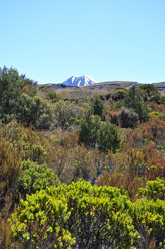
 |
| Mt. Ngauruhoe seen at the beginning of the hike |
 |
| A postcard shot of vegetation on the hike with the destination always in view! |
 |
| We added our own pile to this community effort by hikers on the trail |
 |
| Eyes on the prize! |
 |
| Tongariro Waterfall - the trail would take us all the way to the top |
 |
| Closer to the top |
 |
| Mt. Taranaki on the west coast was visible in the distance |
 |
| The great thing about this hike was that you could see far ahead and know what you would be faced with - it was always reassuring to see other hikers taking it easy... |
 |
| Destination! First lake and Mt. Ruapehu in the background. One of the most spectacular places for a picnic lunch! And a decision point - should we continue up to the second lake? It was a steep climb to a saddle with steep drops on either side. Could I make it up? Could I make it down? Ben was keen to continue. I was tempted to sit and enjoy the view. But the enticement of yet another view pushed me to climb to the top. |
 |
| We made it! Lake #2 and Mt. Nauruhoe watching over it. This was the point where we were in between the two lakes and the two mountains, one on each side. These two shots were taken from opposite sides of the same saddle. |
 |
From this point, It was another 3-4 hours to get back, with many stops on the way and fast declining strength. But it was all worth it! This was the high point of our NZ trip!
|
This relief model shows the topography of our hike to the saddle between the mountains


No comments:
Post a Comment