Going south along the Greenland west coast, we passed by more giant icebergs before we come to Tasiusaq, a place representative of the diverse terrain of northwestern Greenland. The coastline is rocky and slopes up to high peaks. Where we landed is tundra, with a steep climb up to a lake with vistas of mountains in the distance and on the side.
It's a beautiful place for a hike at our own pace - perfect for JOMO - the Joy of Missing Out, an acronym coined on this trip where after that first frantic scramble to see the stromatolites in Port Epworth, we were reminded that we don't have to see everything there is to see. Not clambering up steep slopes on a timed Advanced hike, but enjoying the easy hike and the beautiful flowers, admiring the environment at our own pace and level. At the other end, there is FOMO - the Fear of Missing Out and the accompanying anxiety. As the days passed, more and more people joined the JOMO group.
This stop turned out to be the best hike on the entire trip for me - blessed by gorgeous weather, hiking through golden fall tundra, with flowers still in bloom, discovering plants never seen before, taking photos of the landscape, a little bit of clambering without hurting myself and enjoying the awe-inspiring vistas that come up with every turn. Hope you enjoy the landscape as much as I did.
 |
| Giant icebergs we encountered on the way down the Greenland coast |
 |
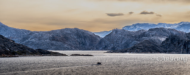
The entrance to Tasiusaq is through a narrow inlet creating a very sheltered bay |
 |
| Different kinds of rocks on the side |
 |
| This shows you the inlet with its steep rocky slopes on the side and where we landed |
 |
| A steep climb up from where we landed |
 |
| Lycopodium |
 |
| Purple Mountain Heather |
 |
| the anticipation of the vistas at the top made the climb much easier, not to mention the flowers on the way |
 |
| A stream and waterfall on our way up |
 |
| Gilled mushroom |
 |
Diseased blueberry
|
 |
| Love those rocks! |
 |
Voilà! The view! We walked all the way around to the other side of the lake until we hit the other lake in front of the tall mountains. |
 |
| Lots of flowers on the tundra still and we were lucky to have Carole Mallory there to name all those plants for us! |
 |
See how the perspective changed as we approached the mountain |
 |
| Suzie, our Inuit expedition team member posed for us in costume |
 |
The hike back yielded yet more different perspectives |
 |
| Another iceberg with the rocks as a backdrop on our way out |
 |
| Back on the ship, there was time for some brave passengers to do their polar dip |
Our third stop in Greenland is in Disko Bayon Disko Island, a huge island off the west coast of Greenland. This landing is very similar to the one at Tasiusaq and the hike is almost a repeat over similar tundra terrain with a bit of clambering over the rocks. We hiked around the lake and saw some interesting plant life. The rocks are not hard to climb up but getting down required a bit more manoeuvering to find a safe path. It was not easy to determine whether you are stepping into a hole because of the thick foliage. I was grateful I had my walking stick with me!
 |
| The lake around which we hiked |
 |
| There are these fern like plants in the lake - I think they may be Mare's tails. |
 |
| Mare's tails |
 |
This is the type of terrain we were walking on. You never know when you will step into a hole! But look how beautiful the flowers were. You can tell we are in "warmer" climes. |

 |
I had the option of climbing that rocky outcrop and continue around the lake or go back the same way over level tundra. My sense of adventure got the better of me and I climbed up the rocks. It was getting down that was the challenge. I was relieved to bump into my travel companion also in the same situation. Two heads were definitely better than one! |
 |
| We made it up these rocks |
 |
The tundra like a carpet in front of us |
 |
| Looking back at the other side to see how far we had come |
|
It was a relief to see the landing spot! As usual, we were the last ones.
Next post: Ilulissat! |
Finally, Ilulissat - a UNESCO World Heritage site and known as the iceberg factory of the world! The Sermeq Kujalleq glacier calves 35cubic km of ice per year. Enormous icebergs from this glacier follow the current north along the Greenland coast, across Baffin Bay then south along the Canadian east coast. This is the source of the icebergs we see in Newfoundland.
We arrived in Ilulissat at sunrise. It was awesome watching the mile upon mile of gigantic icebergs as far as the eyes can see against the pink morning sky as we move towards the glacier. There is no way I could capture the magic with a few photos. We then went on a zodiac cruise around the icebergs in the bay before we went ashore. Going up close to the icy giants gave us a real sense of scale.
It was a wet zodiac ride and a cold morning to boot. To top it off, the shuttle that was supposed to take us to the Ice Centre did not show up. We were able to hail down a cab that took us to the trail to the icefields. It turned out to be a beautiful hike along the boardwalk with colourful tundra on both sides culminating in the specatacular glacier and icefield feeding it.
 |
Sunrise glow backdrop for iceberg alley |
 |

Icebergs as far as the eyes can see

|
| Cruising in between the icebergs provides a different closeup perspective |
 |
| The harbour at Ilulissat |
 |
| Colourful houses |
 |
| The boardwalk trail to the icefields and glacier |
 |
Beautiful tundra flowers on both sides of the boardwalk
 |
 |
| The icefield feeding the glacier |
 |
| The awesome glacier |
 |
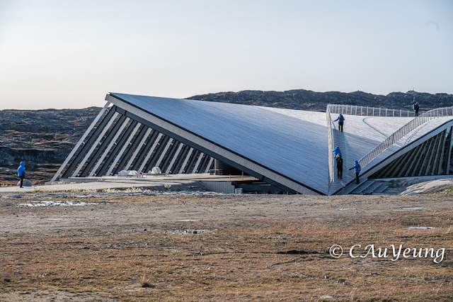
The Ice Centre Museum - you can actually go on the roof for a different perspective |
 |
The inside of the Museum is stunning |
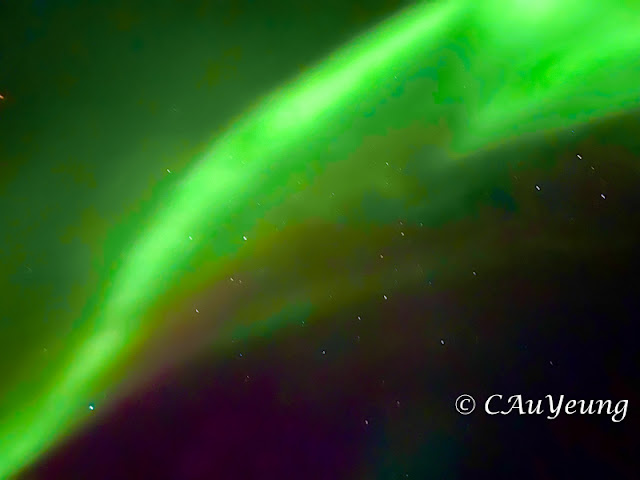
The shuttle was running by the time we finished our tour of the centre so it was a smooth trip back to the ship. We were getting near the end of our trip although each day still brought lots of new vistas and every night, the anticipation of a wakeup call to see the Northern Lights - afterall we are in Greenland, one of the best places in the world to see them!
Our last port of call before disembarkation is Sisimiut (pop. 5,520 in 2022), a coastal town located on the Arctic circle, on the west-central coast of Greenland. The Danish settled here in 1764 and it has developed into a modern fishing port with shipyards and processing plants for fish and shrimp. We had a walking tour of the town and finished with a delicious seafood tasting at the local hotel.
 |
It is a busy port with lots of ships and harbour activities. This is the only place where we get to actually walk off the ship instead of landing on a zodiac. This is where the ship load up on supplies for the next leg of its journey after it dropped us off in Kangerlussach. For the last few days, supplies must have been really low as our green salads were made with shredded cabbage. That night for dinner, we finally got to taste real green salads again! |
 |
The old church from 1775 and below, the new church from 1926
|
 |
The port framed by the whale bone arch |
 |
Drawings on the rock face
|
 |
It's all about boats! |
 |
A lake at the top of the tour |
 |
More colourful houses - you can tell this is the biggest town on our route |
\\
 |
Polar bear skin hung out to dry |
 |
| Shrimp and snow crab legs among other things at the hotel tasting which wrapped up our tour |
Coming up - the Last post: the awesome Kangerlussack Fjord and Northern Lights!!











No comments:
Post a Comment