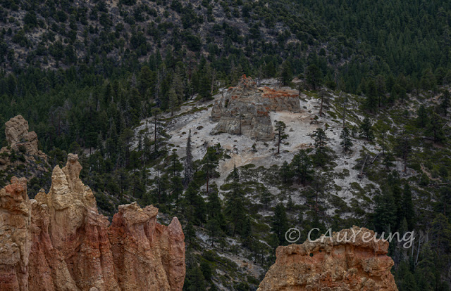
We took the scenic route UT-12 to Capitol Reef, our last stop in the Grand Circle before we return to Salt Lake City. And was it ever scenic! We ooh'd and ahh'd at every turn and tried to stop when we can. Here are just a few shots from those 122 miles between Bryce Canyon and Torrey.
 |
| Aspen grove along one stretch |
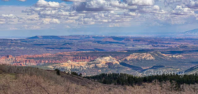 |
The view (possibly the Grand Staircase) from near one of the highest points on the highway at around 9000 ft - it was hailing. |
It took us a few hours to drive those 122 miles and it was almost golden hour by the time we arrived at our hotel in Torrey. This is the view from the hotel.
 |
A sunset paraglide - must be quite spectacular up there |
 |
Sunset was just a reflection in the clouds |
The following morning we set out to explore the park. Capitol Reef National Park is described in the park brochure as "A Wrinkle in the Earth". "Over millions of years geologic forces shaped, lifted and folded the earth, creating this rugged remote area known as the Waterpocket Fold." The Waterpocket Fold is a classic monocline, a geological structure where rock layers are bent and tilted on one side, creating a steep slope. This rock formation below is very typical of the sandstone one would see at the park.
Our first stop was at the petroglyphs a short distance inside the park entrance. These petroglyphs are attributed to the Fremont Culture who lived in the area from around 600 to 1300 AD.
 |
| Putting the petroglyphs in context - they are located in the lower right corner of this massive wall. |
We continued our drive in the park but somehow missed the turnoff to the scenic drive, which turned out to be a good thing because we got to see a different side of the rock formations in the park. They are not red rocks but grey and black shale.

 |
| In this view, the tilting of the rock layers are very obvious. |
We did finally find the Scenic Drive as it was very close to the Visitor Centre and it was 8 miles of scenic wonder as you can see below.
 |
| This is the Castle, made of fractured Wingate sandstone, formed 200 million years ago. It overlays the gray-green layer of the Chinle Formation laid down as volcanic ash (about 245 million years old) and beneath the Chinle is the Moenkopi Formation. (NPS) |
 |
| This is part of the Moenkopi Formation, a 225 million year old rock. Thin beds of reddish-brown |
shale were formed from silt and clay that came to rest in the quiet waters of lagoons, mud flats and coastal planes. The Moenkopi was laid down in a moist tropical climate. (NPS)
 |
| Many of the escarpments at Capitol Reef look like this - rugged, steep cliffs with rock bands of differing thickness, colours, and textures lying one upon another. |
 |
| At the end of the scenic drive is the entrance to the Capitol Gorge, primarily Wingate Sandstone. |
I did a hike on the Hickman Bridge Trail and saw some more geological features. It was a moderate trail that took me close to an hour to complete.
 |
| The trail started along the Fremont River |
 |
| A distinctive feature on the trail is the white Navajo Dome |
 |
| Hickman Natural Bridge |
 |
| This is an "earless lizard" found on the trail nicely camouflaged amidst the sandston |
 |
| After dinner we also did a short hike to the Gooseneck Overlook - nothing on the scale of the one at Gooseneck State Park but more colourful with the different coloured sandstone layers, enhanced by the setting sun. |
While at the park, we attended an interesting ranger talk on geology. One of the takeaways from the talk is the chart below showing the different ages of the rocks at the National Parks we just visited - a great wrap up for this Grand Circle tour through Utah. What an awesome area of the world!
The following morning we drove back to Salt Lake City. This marks the completion of the Grand Circle Utah tour. Thank you for joining me on this amazing journey.