Showing posts with label Arizona. Show all posts

Saturday, 25 May 2013

Off Road Adventure

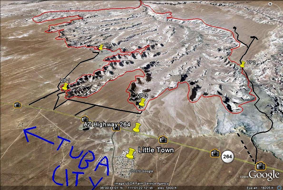
When I read about Coal Mine Canyon on Tripadvisor, I knew I would like to see it and that it might not be easy to find but I didn't bank on a real off road adventure.  A blog site I came across gave us the GPS coordinates for the canyon and told us that it was off Hwy 264 approximately 16.4 miles south of Tuba City.  Then another post said it was much more than 16 miles.  The blog site also had a map of this location.  All this information didn't prepare us for the fact that there were absolutely no signs to tell us which dirt road to take off the highway to get to the canyon.  That stretch of highway was on Navajo reservation land and there were fences beside the highway.  So we looked for a break in the fence quite a bit after the 16 mile point and took our chances.  (For those of you who thought you might try this, the coordinates for the entrance to the dirt road are N35.98621 W911.00059)

It was a little adventurous for us, especially when we didn't know whose land we were on, if we were on the right track or headed in the right direction.  Several times we thought of turning back but we didn't.  The dirt road just went on and on and we came to a point where the track climbed steeply and then dropped - we couldn't really see beyond the top of the hill until we got over it and could very well had dropped down a cliff.   But our sense of adventure egged us on.  We were also lucky we didn't fall off the edge.  We found ourselves at the top of a hill and looking down, canyon land stretched out ahead to the horizon, but no other hint of civilization.


This was an encouraging view and there were other car tracks.  So we kept going and figured it would be safe to follow other tracks that went to the edge of the canyon.  Even then, we played it safe.  We were conscious of the fact that if anything happened to us, we may never be found!  We parked our SUV, rented specifically for this purpose, and walked over to the canyon edge.  See that speck in the distance at 2 o'clock in the picture below?  That's the car.


But what a breathtaking view it was!  All the way to the horizon, not a soul in sight!  It was all ours to look at.  We felt at once the vastness of the land and how small we really were.  It was like we were on another planet.  According to hikers, you could hike into the canyon but there were no real trails, you just followed whatever looked possible.  We were not brave enough for that - imagine falling and breaking a leg or two!  There was no cell phone service - how would one even call for help?


These hoodoos reminded me of Bryce Canyon except these seemed more spread out and had different colours on different layers of rocks.  


It was called Coal Mine Canyon for a very good reason - there were large amounts of coal in the canyon, and you could see the coal seams right here (picture below).


Interesting skirt like formations


It was late afternoon when we got there - you could see the different light effect on the canyon walls.  When we got into our car and drove to another part of the canyon that caught the low rays of the sun, the walls showed a different colour.  Pretty spectacular!


We could see the light fading even as we turned around for more pictures...


So it was time to go back up the hill that we came down -


Probably no big deal for the young, but it was for us an exciting off road adventure - great to do this sort of thing once in a while to keep our nerves in shape...

Wednesday, 15 May 2013

The Famous Horseshoe Bend on the Colorado

After our boat cruise on Lake Powell, we still have an afternoon left to explore the area near Page.  The famous Horseshoe Bend, a meander of the Colorado River,is just a short drive south of Page and a short hike from the parking lot.  It is quite spectacular and I can imagine it will look different at various times of the day -  particularly stunning at sunset.  But it is a 1000 ft drop to the bottom and there are no railings.  My heart dropped a few times when we were there watching little kids insist they be let go at the edge of the cliff...


The hike up to the top - the sandy trail required a lot more energy than usual

Once you get to the top you go down again quickly - with the gaping hole at the bottom

The reward - a stunning view of the Horseshoe Bend - but not for the acrophobic


Fearless couples...


Quite a climb back up to the top

Sunday, 5 May 2013

Slot Canyon #5 - Mountain Sheep Canyon

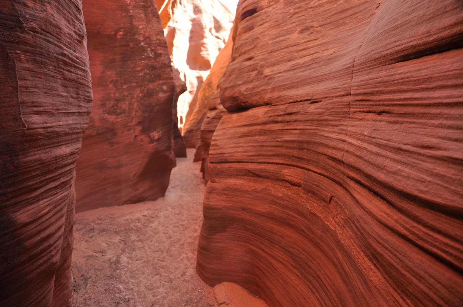
Someone remarked that all the canyons looked very similar.   While the pictures of the sandstone do seemed alike, the canyons themselves are actually quite different with their own character.  They may all have swirls, but the stone texture seemed different in each of them and they were all different heights and widths, thus creating different feel when you were actually in them.  You have to be there.

Mountain Sheep Canyon is the longest canyon of the five (about 1.5 miles) and there is probably a good reason why it's named after the Mountain Sheep - you have to climb up and down quite a few times inside the canyon, like mountain sheep.  The step ladders were secured, but one of them was quite long - climbing up seemed easier as long as you don't look down, but climbing down is not for the faint of heart as you do have to look down to make sure you don't miss a step.  And you have to go back the same way as there is no other way out.   To add to the drama, it was our last canyon of the day, everyone was tired - but we survived.


The entrance to Mountain Sheep Canyon


A well-camouflaged lizard


First time we saw any plant life in the canyons


This canyon is much more rugged than the other four.  You can see that in the stone texture and the harsher lines of the swirls.  


That was a fairly long climb up to a not very steady platform...


Looking down from the platform 


Even the arches you see in this canyon are not as smooth as the ones in the other canyons

Compared to similar shots in the other canyons, you can see the lines here are much more rugged.


And that was the end of our day-long tour of the slot canyons - it was a spectacular adventure!


Friday, 3 May 2013

Slot Canyon #4 - Lower Antelope Canyon

I approached this canyon with a sense of adventure and excitement.   I was a little anxious about it even when I was looking it up online - this is the canyon where 11 tourists died in 1997 because of a flash flood.  There was a memorial plaque near the entrance of the canyon and all who entered were told the scary story of how this happened.  Very little rain fell on the canyon that day but a thunderstorm earlier in the day had dumped large amounts of water seven miles upstream.  Apparently the group was warned that the flood was coming through but the guide was not a local guide and did not heed the warning as they did not see the water.  The homemade wood stairs (since replaced) were washed away with the flash flood and the group had no means of escape.   Our guide showed us the now secured ladders in addition to 10 boxes containing rope ladders along the canyon side that could be released if a flash flood occurs.  

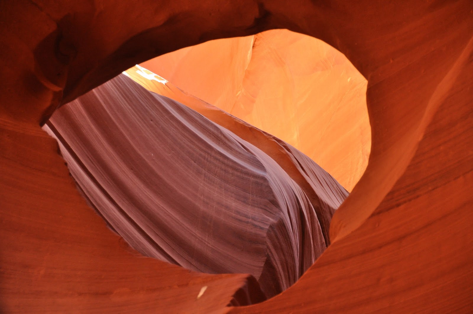
Lower Antelope Canyon, called Hazdistazi or "sprial rock arches" in Navajo, is the deepest and, in my opinion, the most beautiful canyon in the group with spectacular swirls - you can almost see the water whirling through and carving the spirals in the canyon.  The fact that it is all underground made it even more awesome - once you're down there, you're in a different world and you forgot yourself.  It was breathtakingly beautiful with a view around every corner.    See for yourself...

The entrance is most unusual - guess which is the right hole?


and this is how you get in - how would you know that without a guide?!  No need to answer - they won't let you in without one.


Squeeze through then there are steps - much easier than I expected...


This photo gives you a sense of what it feels like when you're down there surrounded by these swirly rocks


Then it goes on and on and on...


You're surrounded...


it's like walking through a dreamscape...


Finally, the way up!


Here's looking back at where we came out -


And beyond - the basin where the water would come out...


It is truly amazing!


Wednesday, 1 May 2013

Slot Canyon #3 Upper Antelope Canyon

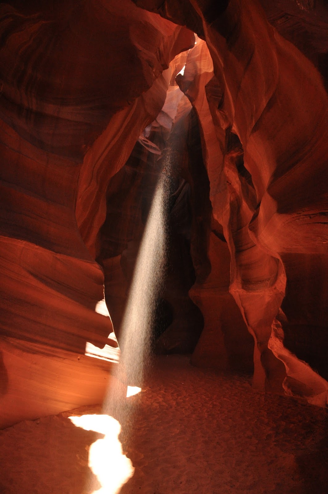
Upper Antelope is the star and the most well-known of the Arizona slot canyons.  It is also the most visited.  Tours are strictly controlled and timed.  Tour guides worked with each other to coordinate where each group stop and for how long.  They staged "shows" inside the canyon - threw dust into the shafts of light that came through the canyon near midday for the photographers, all geared up with their tripods.   It's theatrical.  In a way, the crowds and the theatre detracts from the experience although the "shafts of light" are legendary and are what drew the crowds.  In fact, midday tours are more expensive than other times because of the light show.

The canyon without the theatre is still very beautiful.  It is the tallest of the slot canyons in the area and I could imagine it without the crowds.  If you're visiting, do your utmost to avoid the high season - I can see it would be difficult to enjoy it when you're rushed through and have to jostle for space.


Reminds me of a Lawren Harris painting


This is called "Sunset at Monument Valley"


Shafts of light in different parts of the canyon - photographers are lined up three rows deep to catch this display - some kneeling in the front row, some standing in the middle and the ones without tripods leaning against the wall!


This is "the heart" of the canyon


Another staged effect - sand fall


All you need is an ancient city on the other side to think that you were in Petra...
What you see instead are the open air jeeps the tour companies use to transport people to the canyon.  We were on a full day tour so was driven in an SUV.